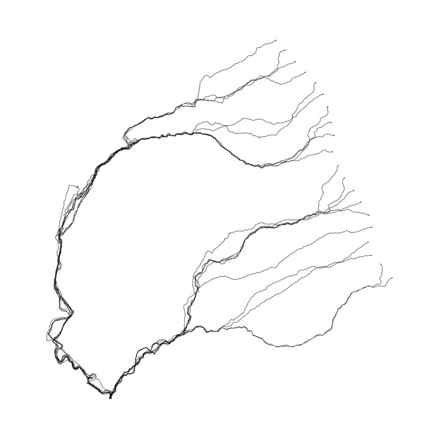
Similar to his Wanderlust Windwalks in 2007, Tim Knowles created a Waterwalk called Path of Least Resistance in 2013. When Tim Knowles was asked by VARC to lead a walk as a part of Art-Walking, he decided to let the walk be determined by the path of least resistance, where the participants would walk as if they were running water, following the shape of the landscape as gravity led them downhill towards an endpoint.

Each participant departed from different starting points along the valley’s watershed, evenly spaced apart, marked by numbered flags. Each walker took their own diverse paths until they eventually joined in similar folds of the landscape, following the stream downhill until they reached the endpoint. Each individual carried a GPS tracker in their backpack that logged their path.
This data was used to create this drawing of the built up tracks, revealing the nature of the landscape. For Tim Knowles, this not only describes the form of the land, but records the action of walking downstream.
As a response, Tim Knowles decided to participate in the same action. In his walk, he noticed evidence of the walkers travelling through the area. He photographed all these instances to make his photo series called Track #1. These photos include bent grass, broken branches, footprints in the mud, depressed moss and more. Combined, these images create a sequence marking the journey made.
Read more about Tim Knowles and his work on his website: http://www.timknowles.co.uk/

Leave a Reply
You must be logged in to post a comment.